Using a single sun-shot and dead reckoning to determine approximate position.
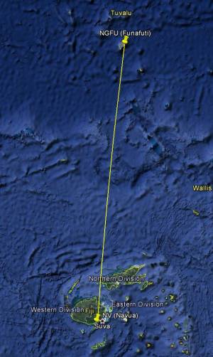
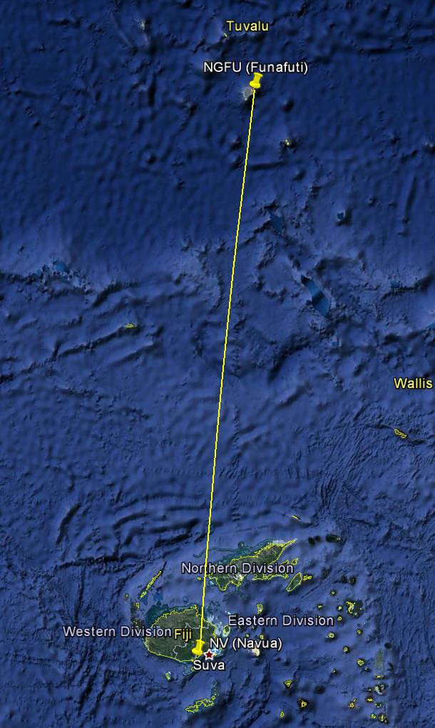
For this scenario we've been flying for 4 hours (at 150kts) from Tuvalu (NGFU) south
towards New Zealand, trying to use an NDB in Fiji as a waypoint:
Unfortunately, we had bad weather, were unable to take any sextant shots so far,
and probably drifted off-course. Our radio was also damaged during the storm,
so we cannot receive the NDB.
Now, after 4 hours we are most likely close to Fiji, with the ground still covered in
clouds, but we are able to take a sun-shot with the sextant, to pin down our position
somewhat.
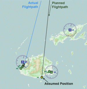
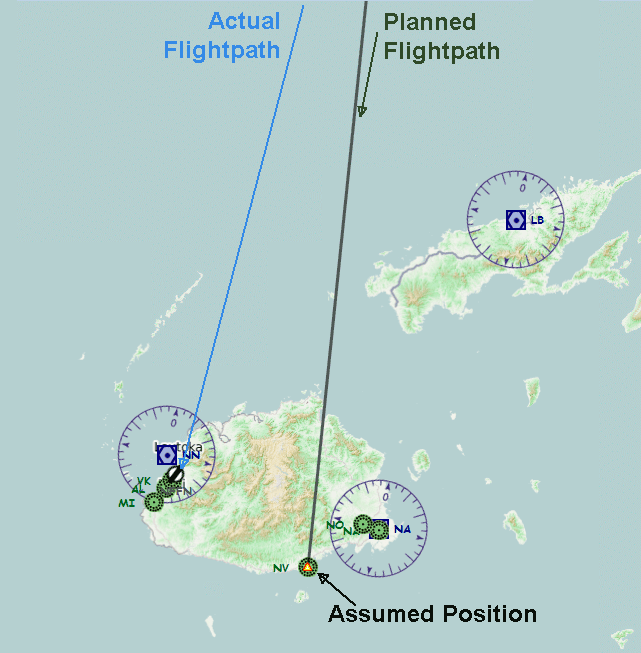
To make it easier to follow the example we will place our aircraft stationary on the
ground, at the Fiji airport NFFN, to simulate a drifted-off flight path,
and use the NDB (our planned destination) as the assumed position (the NDB's position is 18� 14'S, 178� 10'E):
| 1. | Place aircraft at NFFN airport. |
| 2. | Set the time to local 07:00:00, and the date to August 1st, 2013. |
| 3. |
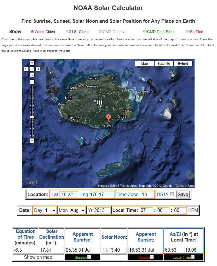
Determine the sun position for the current location & time,
by going either to the USNO,
or the NOAA site,
and entering the appropriate data.
Be aware that the USNO site expects GMT/UT time, and the coordinates in degrees/minutes,
and the NOAA time expects local time with time zone offset, and coordinates in decimals (but the position can also be defined by dragging the pin to the desired position).
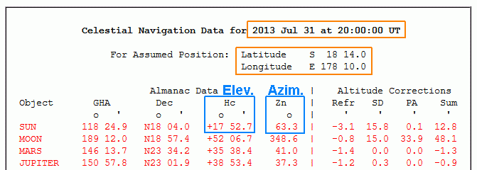
The returned values should be 63 for azimuth, 18 for elevation:
|
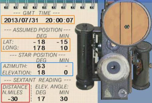
| 4. |
Open the sextant gauge, and enter -18 -15, 178 10 as the "Assumed Position",
63 for azimuth, and 18 for elevation, and take a reading.
The returned distance should be -30:
|
| 5. |
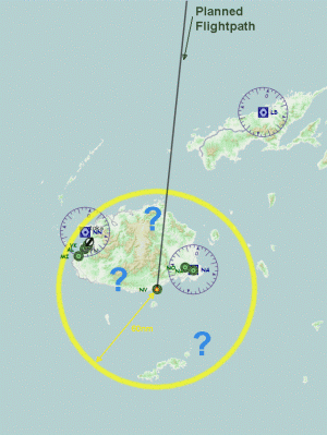
The rule of thumb for dead reckoning is to assume a final position within 10%
of the flown distance (this is our "area of uncertainty").
We flew for about 600nm, so our possible position should be within 60nm of our destination:
|
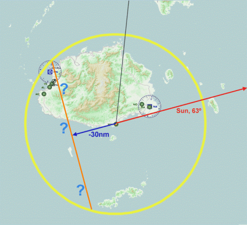
| 6. |
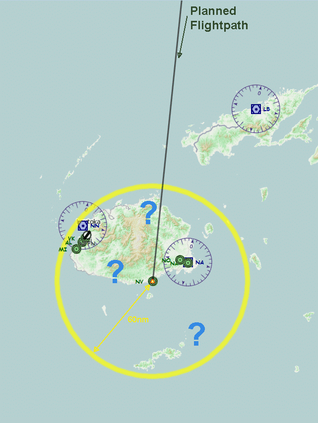
Since the sun's azimuth was 63�, we now draw a line from our assumed position into this direction (red line).
The distance to the assumed position (which was determined via the sextant) is -30nm, so we extend the line 30nm in the opposite direction (blue line).
If the distance had been positive, we would've marked the appropriate position on the existing, red sun-line.
We now draw a perpendicular line (orange) at the end of the 30nm extension,
and keep its size within our marked circle (the "area of uncertainty").
|
| 7. |
Our actual position should now be somewhere near this perpendicular line.
(This line is called our "line of position" or LOP).
It may not seem very accurate for finding exact positions,
but if used en route, it can help to track the offset to the planned course,
or the distance to a destination.
As we can only measure in the direction of the sun, it is often crucial to time
the flight, so that the sun is in the right position at the right moment,
e.g. to check if one is drifting off-course, the sun should be to the left or right
side of the plane.
To check a distance, the sun should be in front or behind the plane.
Navigation just using the sun requires good planning, some creativity, and
accurate dead reckoning, in order to keep the margin of error as low as possible!
|